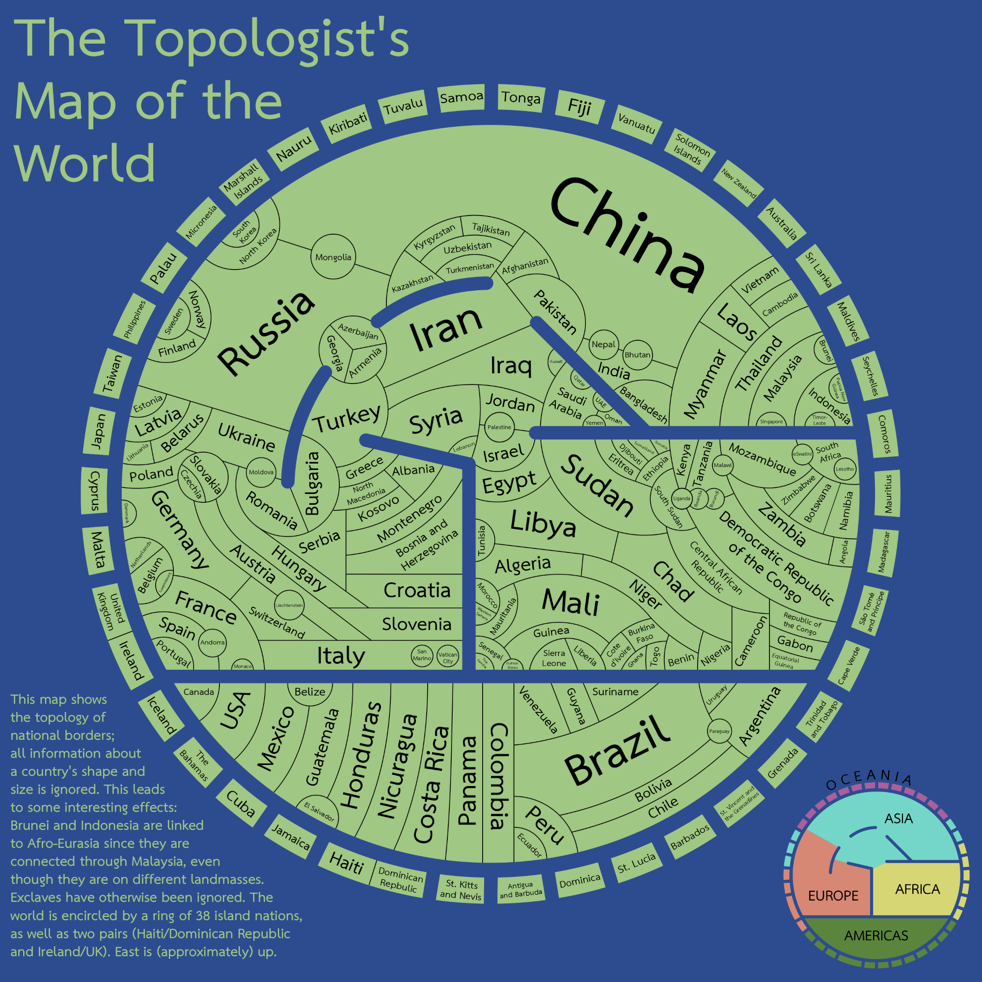
拓扑学世界地图
Topologist's Map of the World

原始链接: https://www.futilitycloset.com/2026/09/01/small-world-20/

Reddit 用户 xilefakamot 于 2020 年创作了这张“拓扑学家世界地图”。它只描绘了国际边界——抛弃了各国原有的形状、大小和地理距离,旨在尽可能高效地展示边界格局。“并没有进行什么计算——我先草绘了一系列展示各国相邻关系的网状图,然后逐渐将其平滑处理,制作出了这张地图——全部是手工完成的。”(来源:MapPorn)

“拓扑学家世界地图”在黑客新闻(Hacker News)上引发了热烈讨论,用户们分析了它将全球地缘政治边界呈现为拓扑图的尝试。 讨论的焦点在于该地图在飞地、领土和岛屿边界处理上的不一致性。虽然作者似乎为了简洁起见省略了许多飞地,但评论者指出了令人困惑的差异,例如包含了某些边界(如摩洛哥),却排除了其他边界(如法国通过海外领土与巴西和荷兰的陆地边界)。参与者还指出,该地图无论是在程式化的布局上,还是在将某些区域置于世界中心的决策上,都与中世纪的“T&O”地图有相似之处。 除了辩论地图的准确性外,用户还分享了相关项目,例如测试用户边界知识的地理益智游戏“世界图谱”(World Graph)。这一讨论串反映了人们对地图绘制复杂性的广泛关注——由于国家边界、飞地和不断演变的地缘政治定义所带来的“混乱”现实,这仍然是一项极其艰巨的任务。
相关文章

原文

https://imgur.com/reddit-oc-topologists-map-of-world-map-showing-international-borders-nothing-else-qGVyb50

Reddit user xilefakamot created this in 2020 — a “topologist’s map of the world.”

It depicts international borders and nothing else — the shapes, sizes, and distances between countries are forsaken in order to present the pattern of their borders as efficiently as possible.

“No calculations per se – I sketched out a series of networks showing which countries bordered each other, then gradually smoothed them out to make the map – all done manually.”

(Via MapPorn.)

联系我们 contact @ memedata.com